Route 29 is the main drag of Napa Valley’s portion of Wine Country. Parallel to it and a few miles to the northeast is the “other” road, the Silverado Trail. There are plenty of wineries to visit along the Silverado Trail, many of which are counted among the best in the valley and some among the best in the world. But there are no restaurants nor any place even to buy a sandwich. There’s no train track carrying diners nor is there as much traffic, although it gets a little busier at what passes for rush hour in Napa Valley.
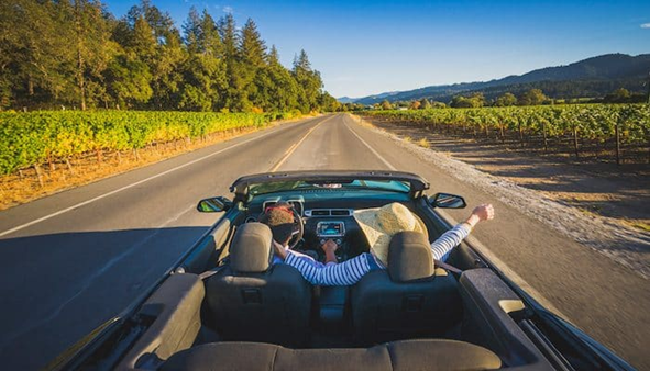
Photo courtesy of Great Runs.
The Silverado Trail begins in the town of Napa, where it is mostly residential and becomes of interest to wine tasters only when it crosses over Trancas Street. At that point, for about four miles, the Oak Knoll AVA is on your left, while the wineries on the right exist in a sort of limbo, identified only as Napa. Since several of the wineries on that side are quite renowned, such as Darioush and Signorello (still rebuilding after the 2017 fire), it doesn’t seem quite fair.
The Trail then passes through the famed Stags Leap AVA (on both sides of the street), where it would be easy to spend a day or two just going from winery to winery. You had better like Cabernet Sauvignon there, because that’s what this area produces in great quantity. Because of the proximity of the wineries and the generally flat lay of the land, there are quite a few visitors who bicycle this part of the Silverado Trail for their tasting experiences.
The Yountville AVA hosts the Silverado Trail for just a short distance with only one winery of note, before the road enters Oakville. There are several wineries there, but they are well separated from each other. The same may be said for the stretch in the Rutherford AVA.
The Silverado Trail is more extended in the St. Helena AVA, where the distance to Route 29 narrows. The AVA with the longest section of the Trail is Calistoga, where the road finally peters out.
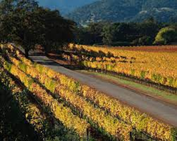
Photo courtesy of Destination 360.
This abbreviated tour belies the attraction of the Silverado Trail. It runs along the foot of the Vaca mountains and has far fewer wineries to visit than Route 29 or the cross roads between the two. As a result, the wide expanses of greenery, sometimes vineyards and other times just mountainsides, make it a pleasure to drive along (or to bike, so they tell us). There are few stop lights from one end to the other. The absence of significant traffic enables you to just motor along and enjoy it all without stopping and starting all the time. And you can even make a left turn if you have to.
If we are going somewhere on Route 29, we generally use the Silverado Trail to drive north-south and then cross over when we near our destination. It is both easier on the eyes and on the nerves.